Derawan, Sangalaki & Kakaban Island


DERAWAN


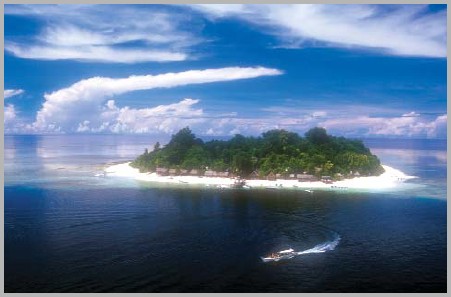
Derawan is a 33 ha island lying off the coast of Kalimantan, and with the islands of Sangalaki and Kakaban, make up an interesting dive area in Indonesian Borneo.

Each of the islands has its own distinct features.

SANGALAKI

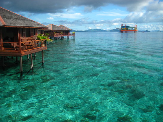
Sangalaki is a tiny limestone speck about 50 minutes by speed boat South-East of Derawan. It is surrounded by gently sloping coral gardens, and has the right mixture of currents and topography to attract the manta rays, which cruise near the surface. It is said that anywhere from a dozen to a hundred are practically guaranteed on a dive. Reefs extend out to about 600 metres from the shore.

It is possible to spend time swimming among the mantas, including the unusual all-black mantas found at Sangalaki. They will come so close to you, providing you don't move out of the way, that you will be able to feel the pressure wave as their wings brush past.

Along Sangalaki's shallow banks are some lush coral gardens which also teem with marine life. There is no evidence of the dynamite fishing damage which is commonplace in other areas of Indonesia. The reef is exceptionally healthy and the diversity of invertebrates is outstanding.

Dive sites include:

  • MANTA POINT

    Gently sloping patch reef frequented by manta rays. These giants, some with wing spans as great as 3.5 metres, fly in graceful circles while feeding in the current line, so they can be seen up close by snorkellers as well as divers.

KAKABAN

Kakaban is 10 minutes from Sangalaki. It is ringed by deep ocean, producing current swept walls decorated with gorgonian fans and twisted sponges, which make for thrilling drift dives. The currents at Kakaban can be strong and capricious - rushing along the walls, upwelling, downwelling, and reversing direction at any moment. The boat, however, will always be there to fetch you when you surface. The most famous spot on Kakaban is Barracuda Point, where there is an ever-present swarm of several hundred toothy silver predators. There is also a shallow sloping wall and reef sites sheltering masses of fish life, including anthias and fusiliers dancing above forests of antler coral.

In the middle of the island is a huge salt water lake filled with non-stinging jelly fish. Snorkelling among these creatures in the two metre visibility is a bit creepy, but definitely worth a visit. Marine biologists have also found a number of unknown species of anemones, tunicates and crustaceans in the lake.

Dive sites include:

  • BARRACUDA POINT

    Currents bring huge schools of surgeons, snappers, trevally, whitetip sharks and barracuda (of course). A grab line has been permanently secured at 24 metres across a relatively flat area on the upcurrent side of the point.

  • BLUE LIGHT CAVE

    In addition to an awesome wall, this is also the site of a deep cave for properly trained and guided divers only. The system starts on the top of the wall at 2 metres and descends through a narrow chimney to a massive, pitch black room at 30 metres. There are two exits onto the wall, one at 44 metres and another at 60 metres.

  • TANJUNG POINT

    Vertical wall with sloping sand chutes on the edge of the reef top. Drift at any comfortable depth viewing everything from lacy nudibranchs to huge sea fans and twisted sponges.

DERAWAN ISLAND

Scorpionfish
Scorpionfish
Derawan sometimes suffers from reduced visibility, but has a diversity of marine life to hold one's interest, including even the most jaded diver - huge lavender seafans, cuttlefish, which pose for photographers, green sea turtles, flat worms and nudibranchs galore, unusual tube anemones, blue-ribbon eels and multi-coloured crinoids. Some of the best diving can be had in the 5 m of water at the end of the Derawan pier, where you will find many of the common Pacific sea creatures - anemonefish, lion and fire fish, puffers, anthias, turtles and schools of batfish, and rarities such as tiny scorpionfish, pipefish, seahorses, green mantis shrimp, squid and many other nudibranchs and tunicates.

Dive sites include:

  • BLUE TRIGGER WALL

    Aptly named for hundreds of blue juvenile red-tooth triggers which wriggle into holes in the wall as divers float by. Wall begins at 18 metres.

  • SEA GARDEN

    Shallow (10 metres) reef with very healthy coral and little current. Many varieties of flatworms and nudibranchs, ribbon eels, large blennies and anemones.

The Sangalaki group is an instinctual breeding and nesting ground for green sea turtles. They have also been the centre of a lucrative local enterprise - turtle egg collecting. Each night on Derawan, Sangalaki and other nearby islands, mature female turtles drag their 90 kg bodies up the beach, leaving distinct bulldozer like trails in the sand. Once they reach an appropriate nesting site, digging begins. The exhausting process of flinging sand with front flippers and pushing with the hind ones continues for hours, until the nest is just the right size. An average of 70 eggs are deposited, carefully covered with sand, before they return to the sea. The eggs hatch in about two months and the infants head for the ocean. An estimated 2 per cent survive to maturity, returning 20 years later to mate and lay their eggs on the same beach. Turtle watching is a favourite evening pastime for divers visiting Derawan, but strict rules are enforced to avoid disturbing the turtles. Observers must watch in silence at a respectful distance without shining a light on the labouring female.

Villagers who used to earn a living poaching the eggs, now earn a living and help preserve the species by hatching, raising and releasing juvenile turtles.


source
source
source

Sipadan Island


Diving in Sipadan Island

The Dive Legend of Borneo

Ever since diving celebrity Jacques Cousteau raved about Sipadan's diversity of marine life, this dive mecca has been indisputably the most famous scuba destination in Malaysia. It is located off the east coast of Sabah, Malaysia's eastern most state, and lies on the north-eastern corner of Borneo, the world's third largest island.

Schooling trevally at Pulau Sipadan

The Sipadan diving legend has passed through the world's dive community to the extent that all divers with an interest in visiting the best sites in the world, have a resort stay at this small island near the top of their wish list.

Pulau Sipadan Island was at the top of Rodale's Scuba Diving Magazine Gold List for 'The Top Dive Destination in the World'. In fact the island shared its top spot with 2 other destinations known for the amazing diversity of their marine life - the Galapagos Islands and Truk in Micronesia.

The list of attractions is quite staggering and all the more exceptional as it involves plenty of big fish encounters - barracudas, large schools of trevally and marauding bumphead parrotfish. This is one of the big fish capitals of the world!

When diving in Sipadan everywhere you turn you'll see turtles, munching on the sponges and algae, or lazing on the wall ledges. If you take the time to look closely at the walls you'll see a wealth of macro life and fish species to rival most destinations, although this is often overlooked due to the other major attractions vying for your attention.

Click here for more information on the history of Sipadan Island.

Highlights

Being around Sipadan is a highlight in itself: Blue skies, clear waters, convenient dive sites and tropical scenery, but it is below the surface where this island really excels:

South Point - This is a dive site typical of Sipadan Island - colourful abundant walls, sharks, turtles and schools of fish in big numbers and all the while the possibility of seeing something really exciting such as hammerheads or thresher sharks. Cruising along you won't be sure whether it is a better idea to poke around in the wall or keep an eye out for the bigger stuff. As with many of the other Sipadan sites, there is no hanging around in the blue doing a boring safety stop. Instead you will want the use of every breath of air in your tank as you spend the last few minutes hovering over coral gardens with as much colourful life and activity as anywhere.

Barracuda Point - One of the favourite dive sites here. Hordes of turtles, vast schools of jacks, bannerfish and snapper are merely bit part players on this site. A variety of sharks are also likely to be spotted but the real stars of this show are the eponymous barracuda. Find yourself in the eye of the hurricane that is the enormous vortex of barracuda here and you will be simply awestruck.

Turtles are literally everywhere at Sipadan Island - photo courtesy of ScubaZoo

Turtle Cavern - This is a site not dived as much these days as it was before the closure of the resorts based on Sipadan Island itself, but it is well worth doing as it is unlike any of the other sites. Before approaching the cave entrance you may well be stunned to see a marauding horde of huge bumphead parrotfish charging past you as you sink down the wall.

The cavern itself is large and intriguing. Turtle skeletons rest on the sea-bed - apparently having met their doom in the confusing passageways of the cavern. Don't worry - those passageways are much too small for you and this is an easy and interesting dive to add to the other excellent sites.

Send your diving holidays enquiry

How to Dive Sipadan

There are several excellent nearby resorts from which to dive here. There are no liveaboards worth considering. The closest resorts are on Mabul and Kapalai. See more in our Malaysia resorts section.

The resort islands also boast some excellent macro dive sites which are a great complement to the breathtaking big fish action of Sipadan Island.

Diving Season

The Pulau Sipadan diving season is year round and most normally expressed as having the best conditions between April and December, especially July and August. The rainy season tends to be between January and March where unsettled weather may result in a decrease in visibility, however in recent years however the timing of the rainy season has been less than certain.

Reef Summary

Great for: Large animals, wall diving, drift dives and advanced divers
Not so great for: Wrecks, beginner divers and non-diving activities
Depth: 5 - >40m
Visibility: 10 - 30m
Currents: Can be strong
Surface Conditions: Can be choppy
Water Temperature: 26 - 30°C
Experience Level: Intermediate - advanced
Number of dive sites: 12
Distance: 12 km (25 minutes) south from Mabul, and 10 km southwest from Kapalai
Access: Diving from Mabul and Kapalai resorts
Recommended length of stay: 5 - 14 days, including the nearby islands


source

source

Mulu National Park (Miri, Sarawak)

About Gunung Mulu


'Heritage is our legacy from the past, what we live with today, and what we pass on to future generations.
United Nations Educational, Scientific & Cultural Organization (UNESCO)

Considering Mulu’s spectacular scenery and its biological significance, it was not surprising that Mulu was successfully listed as a World Heritage site in November 2000. To qualify for world heritage status a park must meet one of the four following criteria:

  • Be an outstanding example of the world’s geological history.
  • Be an outstanding representative example of on-going evolutionary processes.
  • Be of exceptional natural beauty.
  • Contain significant natural habitat for in-situ conservation of biological diversity and the protection of threatened species

Mulu meets all four of these:-

Earth’s history and geological features
… Mulu’s concentration of caves, its geomorphic and structural characteristics are an outstanding resource, which allows a greater understanding of Earth’s history.

Ecological Processes
… Mulu provides outstanding scientific opportunities to study theories on the origins of cave faunas.

Superlative natural phenomena or natural beauty and aesthetic importance
… Mulu has outstanding scenic values, including the natural phenomenon of millions of bats and swiftlets leaving and entering the caves is a superlative wildlife spectacle.

Biodiversity and threatened species
… Mulu provides significant natural habitat for a wide range of plant and animal diversity both above and below ground.

World Heritage status has created renewed interest in the park and a genuine desire of the government and people of Malaysia to ensure it is adequately protected. Accordingly, the Sarawak Government has committed to developing world leading conservation practices and high quality nature-based tourism activities at Mulu and has committed considerable resources to ensure its goals are achieved.

http://www.mulucaves.org
http://www.wildernesslectures.com


GEODIVERSITY ..........................................................................................................................................................
Mulu’s Geo-diversity

Vertical cliffs and incredibly steep slopes reach summit ridges
before dropping abruptly down to deep gorges and hidden valleys.

Jagged limestone pinnacles, bleached white, spear out of the lush green canopy.

Cave passages twist and wind their way through the mountains, opening into chambers
so large they defy description and dwarf you into insignificance.

In landscapes like these, to understand what we see today, we must look to the past.

Many, many millions of years ago, new mountains pushed high above the earth’s surface were rapidly eroded by the heavy tropical rains. Eroding rock produced grains of quartzite sand, which were carried by rivers from the mountains into the sea. Here it settled over time to form layers of sandstone. Again, the earth moved and its surface buckled and lifted, and so, the island of Borneo was created.

In an ancient sea teeming with sea life, coral reefs developed to form lagoons between the reefs and this new island. Some 40 million years ago, these lagoons began to fill with layer upon layer of minute sea shells which compressed over the next 20 million years to become a layer of 1,500 metre thick limestone.

When the movement of the Australian and Asian landmasses caused the earth’s surface to buckle and fold about 5 million years ago, the land lifted once more. Tilting and cracking, the layers of limestone and sandstone were pushed up to create the mountains of Mulu.

The relentless process of weathering by the elements of rain and time now began to shape the landscape we see today.

Although limestone forms in sea-water, it has two very special features - it is porous, and it dissolves in fresh-water. As the rain falls on these limestone mountains, it passes through the soil and into the limestone itself through very small pores and cracks. Seeping and trickling through the limestone, the water gradually dissolves the rock, making these pores and cracks larger and larger to create a remarkable series of cave chambers and passages.

And here at Mulu you’ll find, the biggest caves in the world


BIODIVERSITY .............................................................................................................................................................

In Mulu, the heart of wondrous Borneo, you will be amazed by the rainforest around you. In the humid heat, plant life flourishes everywhere. Many thousands of species of ferns, mosses and flowering plants along with thousands of species of fungi thrive in this complex habitat.

52,000 Hectares of spectacular equatorial rainforest presents visitors to Gunung Mulu World Heritage Area with an outstanding diversity of flora and fauna. This is home to many fauna species from the world’s smallest mammal the Savi Pigmy Shrew to some of the largest insects on Earth. In the dense foliage secretive macaques, bearded pig, moon rats hide, blending in so well that we rarely see them.


Forest types

Look up at the tall towering trees blocking out the sky with their dense canopy. Richly coloured butterflies glide among trees entwined with lianas, ferns and orchids. The ground is a thick mat of leaves and fresh new seedlings struggling to find their own space. The heartbeat of life is all around you, plants and animals, living, eating and dying.

Strangler figs, spread by fruit-eating birds, begin life germinating high in the canopy. Growing quickly in the sunlight this parasitic plant creeps down and around the host tree. Becoming larger and stronger and clinging to every surface available, strangling the tree in its death grip. Finally, the tree will die and rot away, leaving the fig standing as a shell of the tree’s former shape.

Watch out for the rattan, a thorny vine reaching for the sun, it entwines its way for up to 100 metres through the trees. An important plant for local people used in weaving but for the unwary, it’s a painful meeting.


The air is rich with the perfume of 170 species of wild orchids. If you are lucky you will see the famous Slipper Orchids, or you may spot the curious shaped pitcher plants. Mulu is home to 10 species of these insectivorous plants which supplement their diet by eating visiting insects.

Some plants use animals in other ways. One species of ginger, flowers at ground level and exudes a pungent smell. Beetles rolling balls of dung, in which they will later lay their egg, are fooled into thinking there is fresh dung and eagerly seek it out.

The beetle gets no dung, but the flower does get pollinated.

But why is Mulu so diverse? Well its topography ranges from just 50 metres above sea level near park headquarters to the peaks of Gunung Mulu at 2,377 metres, and let’s not forget the unique underground environments in the caves. Combine this with a geology of alluvial clays, sandstone and limestone formations to produce dozens of niches and specialist environments for both plants and animals.


MEET THE PEOPLE OF MULU ..........................................................................................................................................

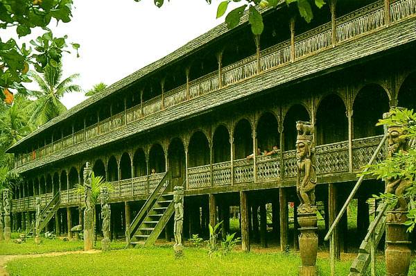
Lun Bawang, Murut and Iban to the north, Kelabit in the south east, Berawan and Penan to the south and some nomadic Penan within the boundaries of the park; all have lived in this rainforest since time began.

Here in the mountains the local people are known as Orang Ulu, ‘up river’ people. They are a diverse group of many cultures – Kayan, Kenyah, Berawan, Penan, with a remarkable understanding of the rainforest, they have used for generations for their food, medicines, tool making and building shelters. Today this deep connection to the land still exists in the heart of the people of Mulu.

Three longhouses are found close to Park Head quarters – the Penan communities at Batu Bungan and Long Iman and Berawan at Long Terawan.


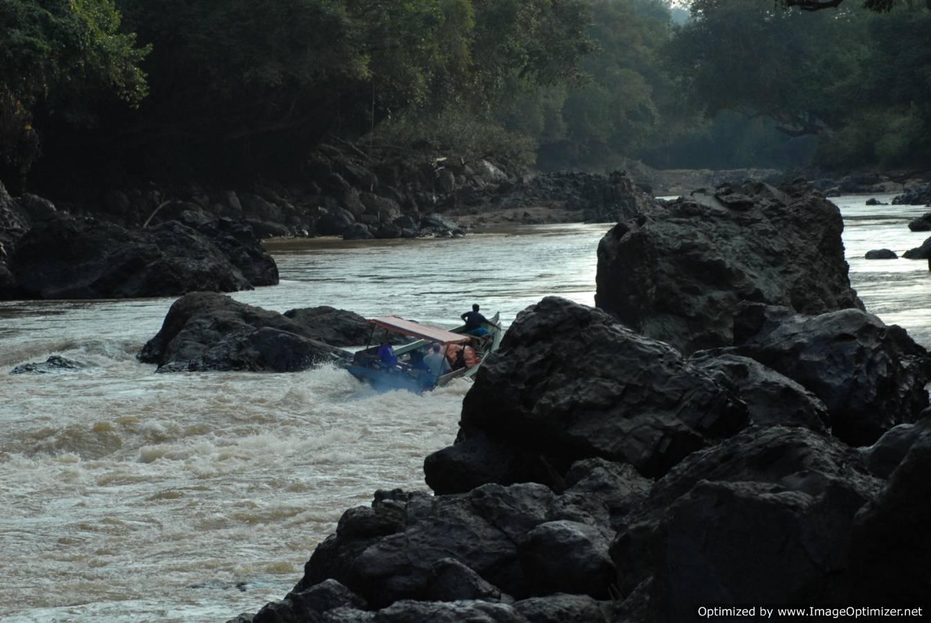
Rivers are not only the lifeblood of the rainforest and the caves but also for the people of Mulu. Longhouse life centres around the Melinau and Tutoh Rivers for transport, washing, food, play and for simply watching the world go by. Travelling along the Melinau to Wind and Clearwater Caves gives visitors great insight into the everyday activities of these communities.

Go downstream on the Melinau and feel the force of the larger Tutoh River as your boat swings up stream towards Long Iman, a Penan Longhouse. They welcome visitors to the handicraft market and their displays of medicinal plants where they will share their ancient knowledge of how plants can be used even today.

source

source

Kayan Mentaran National Park & Tana Olen - Kalimantan Timur


Kayan Mentarang National Park is a densely forested national park in East Kalimantan province, Kalimantan, Indonesia. The national park is named after a great dispersed (Mentarang) mountain trails plateau of Apau Kayan which covers entire park from Datadian area in south region to Apau Ping area in mid region until Long Bawan in north region.

Animals found in the park include the Malayan pangolin, the Long-tailed macaque, the Proboscis monkey, the Bornean Gibbon, the Greater slow loris, the Western tarsier, the Clouded leopard, the Marbled cat, the Flat-headed cat, the Oriental small-clawed otter, the Sun bear, the Hose's palm civet, the Rhinoceros Hornbill, the Helmeted Hornbill, Bulwer's Pheasant, and the Wrinkled Hornbill.


Visit Kayan Mentarang National Park Wild Life Wealth

Gateway to Kayan Mentarang
Kayan Mentarang National Park covers an area of 1,600,000 ha and is located in the far interior of East Kalimantan province. The park comprises the largest remaining block of rainforest in Borneo and as such forms a very important refuge for numerous species, including many species that are endemic to the Bornean mountain bioregion. About half of the reserve consists of species-rich dipterocarp lowland and hill forest while mountain forest ranges up to Kayan Mentarang's highest mountain at 2,000 m. 40 Percent of the park has an elevation above 1,000 m. The park is inhabitated by several thousand Dayak and Punan people who live from shifting cultivation and rice farming. Wildlife is hard to see due to hunting by native Dayaks. WWF has been working on developing eco-tourist projects in cooperation with the local people. It has 5 field-offices in settlements around the park, which are helpful for information. It also has a research station at Long Alango, north of Long Pujungan, which can be visited, and is probably the best place to see wildlife.

Access Kayan Mentarang National Park is very remote and only accessible by public flights on the Samarinda-Long Ampung and Tarakan-Long Bawan routes, or by public riverboats following the Tarakan-Tanjung Selor-Long Pujungan route. To access the southern part of the Park, visitors can fly from Samarinda or Malinau to Long Ampung. From Long Ampung head for Data Dian (an approx. 5 hour journey on 13 HP boat engines). Since fuel is extraordinary expensive. However, visitor's with time can get around half the price when asking for a lift with the locals who go to Data Dian.. MAF (Mission Aviation Fellowship) has flights, However, both DAS and MAF require advanced booking (minimum 1 month before departing date),and both airlines reserve the authority to prioritize seats for local citizens from around the Park - so outside visitors often find themselves stranded even after numerous seat reconfirmations. It is good to bring luggage less than 10 kg in weight when flying with DAS (DAS limits each persons weight - including luggage - at 80 kg). This makes it more flexible to secure a seat on board on last minute seat availability. MAF puts even more restrictions on luggage weight (up to 10 kg/person) on regular flights unless chartered.

Accommodation There's no official accommodation, but it's possible to stay in the many Dayak settlements inside the park.

Tour Destination : Indonesia, East Kalimantan, Kayan River Main Interest & Things to do : Jungle trek, and exploring the Flora and Fauna which can't be found anywhere else in the world, as only in this largest National Park of Indonesia.The Dayak Culture along the Kayan River, as in Long Alango, or Long Pujungan is Traditional Dayak Culture.Recommended visit time for Kayan Mentarang Reserve and Kayan River is 5 to 8 days Culture : Dayak Kayan & Punan Flora & Fauna : Tropical Rainforest and Wild life Tour Starting Point : Balikpapan either Tarakan Tour Transport Possibilities : by Flight from Balikpapan to Tanjung Selor, or direct from Jakarta to Tarakan, continue by speedboat to Tanjung Selor, estimated travel by speedboat is 2 hours to reach Tanjung Selor.Crusining up with a combination of public longboats and chartered longboats to places as Long Pujungan and Long Alango Tour Ending Point :
Balikpapan or Tarakan, from Tarakan you can cross the border via Nunukan to the City Tawau in Malaysia Travel Distance to enry point :
900 Km from Balikpapan Airport
100 km from Tarakan Airport Tour Duration : Short Get Through Visit 5 to 8 Days Accommodation & Hotels : Local Houses or Jungle Camp Tour Grade : Challenging


source

source

source

Jangkar waterfall, Kuching


The water is so clean and fresh that some of us drink it raw from the creek.

This is a typical scene of the beginning trekk through the rocks and creeks that we have to go through for 1.5 hours, sometimes crossing the stream, the rocks, and at times walking through dense jungle undergrowth when the rocks are impossible to climb.

At the lower end of the foothill, the rocks are round shaped and smaller. As we go higher, the boulders become big and sharp edged.

One explannation is this. The forces of water rounded up the small boulders and carry them down to deposit at lower end. The larger boulders are cut by shear force and due to large size, they are difficult to wash down.

As we go higher up, the rocks are part of large plates of formation. At the waterfall itself, the plate is almost whole pieces of unbroken formation.


The Tip of Borneo - Tanjung Simpang Mengayau


The Tip of Borneo - Tanjung Simpang Mengayau
Kudat

This dramatic headland is situated in the northern-most tip ofBORNEO, the third largest island in the world, after Greenland and New Guinea. It is located in the Kudat Peninsula, about three and a half hours (or 215 kilometres) drive from Kota Kinabalu City.

Simpang Mengayau means 'lingering junction' as it is here that the South China Sea lingers and meets the Sulu Seas flowing from the east ... Enjoy the stunning view. The sunsets and full moons are just beautiful ... The Pulau Kalampunian lighthouse is a reminder of treacherous coastline and past shipwrecks. On the left is the beautiful beach of Pantai Kalampunian.

It's a lovely easy stroll to the flagpole, the Globe and the rocky outcrop that forms the "Tip of Borneo".

Facilities:

There is a cafe, souvenir shop and washrooms.

Admission is free.

Getting there (from Kota Kinabalu)

You can go by taxi, self-drive or with a tour agent. Four-wheel drives and saloon cars with permits are stationed near the Indian Restaurant opposite the Health Clinic in Kampung Air. Four-wheel drives can take between 7-8 passengers at RM20.00 - RM25.00 per pax return, while saloon cars take up to 4 passengers and charge RM240.00 for a return trip to Simpang Mengayau. Check with the Car Rental services for their charges.


Extra information

Day trips are offered by local tour operators. Rates start from around RM 250.00 which will include a tour to theHoney Bee Farm at Kg. Gombizau, the Gong Factory at Kg. Sumangkap, a visit to a Rungus Longhouse with lunch and The Tip of Borneo. Check with the tour operators for more details.


source

RAPAK PLAZA, BALIKPAPAN

Balikpapan is a seaport city on the eastern coast of Borneo island,Indonesia in the East Kalimantan province, a resource-rich region well known for its timber, mining and petroleum export products. Two harbors,Semayang and Kariangau - ferry harbour, and the Sepinggan International Airport are the main transportation access to and from the city.

Geography

The topography of the municipality of Balikpapan is generally hilly (85%), with only small areas of flatland (15%), particularly along the coast and surrounding the hilly areas. The hills are less than 100 meters higher than the adjacent valleys. The altitude of Balikpapan ranges from 0 to 80 meters above sea level.

Most of the soil in Balikpapan contains yellow-reddish podsolic soil andalluvial and quartz sand, making it extremely prone to erosion.


Transportation

Balikpapan's airport is the Sepinggan International Airport. This is the busiest airport in Kalimantan and permits large aircraft.

Airlines currently using the airport are Lion Air, Merpati Nusantara Airlines, Batavia Air, Trigana Air, Kartika Airlines,Sriwijaya Air (domestic routes), and Garuda Indonesia, AirAsia, and Silk Air (International routes).

The airport is one of the five principal sites in Indonesia where Muslims begin the pilgrimage to Mecca, the "Hajj". Between 1996 and 1997, the airport served over 4,500 East Kalimantan pilgrims, and from 1997 to 1998, it served pilgrims from East Kalimantan, South Kalimantan, Central Sulawesi, and North Sulawesi.

Other than the airport, Balikpapan also has a seaport called "Semayang" which has many destinations to Surabaya,Makassar, Jakarta, Pare Pare, and Manado. In 1990s, transportation using ships was very popular. But after the booming of so many new airlines with very cheap price, people now prefer travelling using airplanes to the ships.

The ferry is also another alternative for travelling to other places within coastal areas in East Kalimantan, such as Penajam.


Diving on Maratua Island-Kalimantan timur


GETTING THERE
To go to Maratua Island in Indonesia is basically the same way as to Derawan. After arrival in Berau (Tanjung Redep) you are transfered in 4 hs. by speedboat to Nabucco Island inside the large lagoon of Pulau Maratua. Maratua is approximatly 4 km long and the northern half of the lagoon rises sharply out of the water. This part is inhabited. The southern part is below water level with some tiny islands on top of the reef edge. Outside the reef the sea bottom drops sharply to over 2000 m. The neighbouring islands Kakaban and Sangalaki can be reached in one ore one-and-a-half hour, depending on weather conditions.

THE RESORT

Extradivers have established on Nabucco Island an exclusive resort. The aim is obviously to reach Maldive-Standards. The size of the island is only 20 000 m². Extradivers have erected 8 airy and comfortable double bungalows most of them with a view to the sea.

Also ecological standards are very good: There is a biological treatment of waste water and drinking water is processed rain water.

It is only possible to book half pension on Nabucco. There is a big breakfast and a five course dinner. Lunch and all drinks (drinking water, coffee, tee) must be bought at the restaurant. The prices are also maldive like. So you have to add to the price you pay for your package all the costs for additional meals and drinks. We could not understand why the owners did not reduce the number of courses for dinner and offer a small lunch instead. Maybe it is simply another way to extract some extra dollars out of the guest`s pockets.

The dive shop on Nabucco Island is modern and in excellent condition. There are several speedboats in different sizes which can reach the dive spots off Maratua in 10 to 20 minutes. Kakaban and Sangalaki may be reached in one hour or one-and-a-half. If the weather is bad this trip may last longer. The local diveguides know the dive sites very well. However we were a bit unlucky. Our guide was totally unmotivated and became only active when signalling to come up after excactly one hour under water.

source

Balikpapan City Gateway to East Kalimantan


Balikpapan is the main gateway to East Kalimantan province. It has grown in importance since the opening of the International flight routes. This town of about 500.000 is also visited by Pelni passenger ships on the route Surabaya - Ujungpandang - Balikpapan.
Outwardly, Balikpapan presents two different faces. The first is the old Dutch-built section of the town. The other is the newer part that as gown as a result of recent development efforts.
Most destinations, such as the Dayak settlements in the hinterland along the big rivers, can be reached from Samarinda, moreover, a visit to Kalimantan does not seem complete without a visit to East Kalimantan. The forests of East Kalimantan contain a wealth of rare flora and fauna. The black Orchid (Clogena pandurata), Nephents Amularia and Rattan vines growing up to 200 meters long, grow in these forests. So do various species of valuable tropical hardwoods. Among the animal species typical of Kalimantan, living in the forests are chimpanzees (Pongee pygmaeus), bekantan (Nasalis Larvatus), Mahakam fresh - water dolphins or pesut (Orcela fluminalis) and many bird varieties. The cultural and artistic traditions of the island's indigenous Dayak population are still preserved in this region, especially in the hinterland of East Kalimantan. Sailing up the streams near the Malaysian border, one can still meet Traditional Dayak settlements than seem to have been little touched by the advent of modernity. Balikpapan The name Balikpapan is presumably derived from an overloaded ship, which capsized near Tukung Island. A Dutch geological map in 1870 contained a small village of that name on Balikpapan bay. Now East Kalimantan's leading oil town, and one of the most important in Indonesia, Balikpapan was during World War II the target of assaults by both the Javanese and the Allies. Balikpapan is the main gateway to East Kalimantan province. It has grown in importance since the opening of the International flight routes. This town of about 500.000 is also visited by Pelni passenger ships on the route Surabaya - Ujungpandang - Balikpapan. Pasir Ridge
The first contains most of the residential neighborhoods of the oil enterprises, such as Pasir Ridge or (American Village), in the hills. It is a self sustained entity, pleasant and provided with all the facilities for modern living, including good roads and parks.

Manggar Beach Manggar Beach is nor far to the west of Balikpapan. It is very popular among the local people, who go there to bathe or simply relax.

Tanjung Jumelai is beach near Penajam village which can be reached by motorboat. The area is both beautiful and pleasant.

Tanjung Harapan, at Samboja, 40 kilometers from Balikpapan or 70 from Samarinda, is an attractive beach, six kilometres long, grown with trees and mangrove forest. Recreation facilities are available.

Tour Destination : Indonesia, East Kalimantan, Balikpapan

Main Interest & Things to do :
City sightseeing Tour,visiting Manggar Beach,Japan Monument,Crocidile Farm,and Bankirai Jungle Trek
recommended visit time is 1 or 2 days
Balikpapan is an booming oil city, and the entry point with an international airport ( flights from Singapore ) to the dayak country East Kalimantan province.
Manggar beach north of Balikpapan city, is the most famouse beach and relax place at Balikpapan, about 15 km from the center of the city
Crocodile farm near Manggar Beach is a tourism object for mostly local visitors to see crocodiles and the farming system The Japan Monument, reminds to the Japanese invasion, and can be found in almost the center of the city.
Several shopping malls, international and simple Hotels are available in Balikpapan.
Bukit Bankirai, or Bankirai National Park, is located on the way to Samarinda, orangutans, monkeys, wild orchids and other kind of tropical flora and fauna including several kinds of wooden trees can be found here, overnight can be done in the resort of Bankirai, to know and experience the sounds and the jungle by night.

Culture : Javanese,Buginese,Kutai and Dayak Mix

Flora & Fauna : farming, plantations and lowland Rainforest can be found outside of Balikpapan

Tour Starting Point : Balikpapan, East Kalimantan, Indonesia

Transport Possibilities : Public Bus and chartred car.

Tour Ending Point : Balikpapan, East Kalimantan, Indonesia

Travel Distance to enry point : 0 Km to from Balikpapan Airport

Tour Duration : Short Get Through Visit 1 to 2 Days

Mount Kinabalu 4093m


Mount Kinabalu is the highest mountain in south-east asia and offers a unique climb from tropical luxuriance through montane oak forest to the rocky sub-alpine summit plateau. The climb starts from Mount Kinabalu Park Headquarters, only a couple of hours drive but already more than 1500m above Kota Kinabalu on the coast. Here is ample accomodation from dormitories to comfortable two person cottages. The climb is usually done in two days from here. The use of an authorised guide is compulsory while a porter is an optional luxury.

Many of the trees and flowers are unique or extremely rare but to the uninitiated novice in matters botanical there is no doubt that the pitcher plants steal the show. Even the most casual observer cannot fail to notice these impressive insect guzzling monsters with up to a pint of liquid waiting to lure and drown the passing fly or mosquito.

Just above the tree line at 3350m is a comfortable rest house where most parties spend the night. My sunset picture is taken just outside this mountain hut.

Before dawn next morning everybody is up and climbing by torchlight towards the summit. A steep rock step is aided by a fixed rope which, when we were there, continued all the way to the summit even where the way became quite flat. Many people have been lost on the mountain in the past, some never to be seen again. The rope and the compulsory guide make this now extremely unlikely even in the thickest mist. Nevertheless the early start is a good idea to enjoy the views before the regular mist descends on the summit. This is something which I can only speak of by hearsay as we enjoyed a rare occasion when the mountain remained clear all day.
It is not a good idea to climb too quickly as the wait for sunrise at the summit is exceedingly cold. The picture shows the rising sun illuminating the mountain's third summit, Victoria Peak. The arrival of daylight reveals the remarkable summit plateau of the mountain, a vast expanse of smooth rock with a weird assortment of rocky pinnacles rising from it, like the udder of an inverted cow as I have heard it sacreligiously described. By good fortune for the peak bagger the highest pinnacle, Lows Peak, is also one of the easiest. On the way down you can take a glimpse into the dizzy gash of Lows Gully which splits the eastern side of the mountain. With the early start the descent to Park Headquarters is easily done in one day, now with the glow of satisfaction of having climbed one of the world's most spectacular and interesting mountains.

click here for original article